
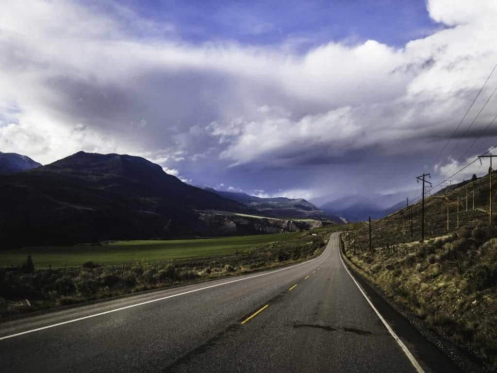
The Canadian province of British Columbia is big. Like, really big. Bigger than California. Bigger than New Zealand. Four times larger than the UK and Ireland. There’s a lot of room to move in BC, and even more to see and do for the intrepid traveler keen on great road trips in British Columbia. The provincial highway system is vast and well-maintained, perfect for planning journeys on two or four wheels. Whether you’ve got a day, a week or a month, we’re highlighting 8 of the best BC roadtrips in Canada’s most western province.

8 Spectacular BC Roadtrips
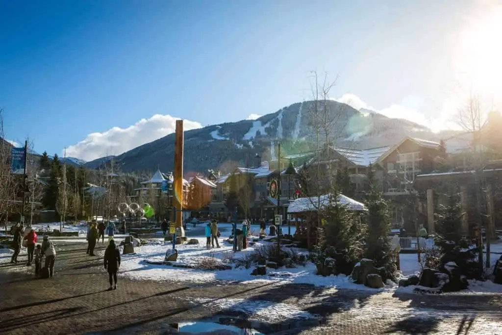
1. Sea to Sky Highway
Vancouver to Whistler: 162 kilometers
One of the best drives in the world, the Sea to Sky Highway 99 shows off coastal British Columbia at its absolute finest. This beautiful roadway between Vancouver and Whistler begins in downtown Vancouver. It winds its way through Stanley Park, West Vancouver and Horseshoe Bay. Then along the deep blue Howe Sound fjord, past waterfalls, provincial parks, temperate rainforests and attractions. The Sea to Sky drive makes for a perfect day trip from Vancouver.
Stop for a visit and pan for gold at the Britannia Beach Mine Museum. Admire the spray of Shannon Falls, then take a ride up the Sea to Sky Gondola north of Squamish for an interpretive hike. Experience Indigenous culture with a First Nations tour guide. The views of Howe Sound, the Stawamus Chief, and coastal mountain peaks from the suspension bridge and viewing deck are unforgettable.
Whistler’s small-town mountain vibe offer something for everyone in every season. Whether it’s epic skiing and riding in winter, or hiking, mountain biking or swimming in Lost Lake in summertime. And there’s no shortage of fine or casual dining for romantic dinners or family feasts whether it’s in Whistler Village or in Creekside.
Note: You can do the Sea to Sky Highway drive return-trip in one day.
Use the map below to search for hotel and short-term rental options
Bonus Drive: Duffey Lake Road
Pemberton to Lillooet: 99 kilometers
Continue your British Columbia road trip past Whistler to Pemberton and head north along the beautiful scenery of the Duffey Lake Road. Driving from Pemberton to Lillooet on the Duffey Lake Road is well worth the journey. This winding open road passes through mountainous terrain and is part of the Discovery Coast Circle Route. The short drive climbs through narrow canyons overlooking rivers, past mountains, lakes and waterfalls.
Popular attractions include Nairn Falls and Joffre Lakes Provincial Parks, the latter having some of the busiest hiking trails and park areas in the province during summer. The road includes a few pullouts for wildlife viewing and photography but note that they’re too small to accommodate large vehicles like RVs.
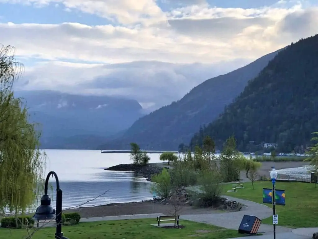
2. Pacific Marine Circle Route
Victoria Loop 255 km
Vancouver Island’s Pacific Marine Circle Route is one of the most spectacular BC roadtrips. It combines the best of urban city life with the wild beauty of the Island’s southwest coast, and the rolling hills and lakes of the picturesque Cowichan Valley.
Moving west from the provincial capital Victoria, the route takes in the geologically significant Sooke Potholes Provincial Park, then winds along the sandy beaches fronting the Pacific Ocean. Stop to see the action at the surfing beaches of China, Sombrio and Jordan River. You’ll also pass the Juan de Fuca Marine Trail and Port Renfrew, the trail head for the famous West Coast Trail.
While this BC road trip route can be done in one long day, we recommend an overnight stay in one of the beachfront cottages at Wild Renfrew. Have an outdoor adventure exploring the tide pools and sea life at Botanical Beach in Juan de Fuca Provincial Park. Then head off-road to explore Big Lonely Doug and fellow giant fir and cypress trees in the emerald rainforest of Upper Avatar Grove.
The scenic drive inland reveals rolling hills on route to Cowichan Lake, and attractions that include the BC Forest Discovery Centre, a self-guided First Nations Totem Tour Walk, and the vibrant and walkable downtown of Duncan.
Make a pit stop at the seaside village of Cowichan Bay. Enjoy its small-town charms, including farm markets, the Wild Coast Perfumery, ice cream shops, many arts and crafts galleries and wine tasting at Blue Grouse Winery.
The return home to Victoria can include a ferry diversion to Brentwood Bay from Mill Bay. And do stop and smell the roses, tulips and scores of other flowers and plants at renowned (and dog-friendly) Butchart Gardens.
3. Sunshine Coast Route
Vancouver to Lund: 198 km
The Sunshine Coast is less than 30 km (18 miles) from downtown Vancouver but the ferry ride to get there from the Lower Mainland sets the stage for what will be a leisurely tour of this local coastal landscape.
The entire drive to the end point of Highway 101 at Lund can be done in a day and involves two ferries, the first from Vancouver and second up the coast at Earls Cove. However, the pace of life on the Sunshine Coast invites travelers to savor the journey and enjoy its scenic drives with views of the Salish Sea, Texada, Lasqueti and Vancouver Islands.
Stop in to some of the quaint coastal towns like Sechelt, Secret Cove or Halfmoon Bay on your way to a second ferry at Earls Cove. Before departing, detour to Egmont and hike to Skookumchuck Narrows Provincial Park to see an incredible natural phenomenon. Here, the Sechelt Rapids surge through the Narrows during a 3 m (10 ft) tide change twice daily. The change causes 200 billion gallons of water to explode upwards into standing waves and be sucked into churning whirlpools. This is a popular for experienced kayakers and surfers, and those who enjoy aquatic thrills.
Continuing north, the funky and historic town of Powell River awaits exploration. Sample the delights of BC’s Ale Trail with a craft brew at Townsite Brewing, or stop in for delicious pasta and pizza dishes at Culaccino Modern Italian. The road ends in tiny, historic Lund for a stay at the Lund Resort at Klah Ah Men. Don’t miss the cinnamon buns at Nancy’s and terrific fish and chips and amazing sunsets at the Boardwalk Restaurant before continuing a marine journey into Desolation Sound.
4. The Fraser Valley
Vancouver to Harrison Hot Springs: 122 km
Make the journey your destination and take the road less travelled into the Fraser Valley along Highway 7. This is one of the more relaxed and scenic BC roadtrips. From Vancouver, the route heads eastward towards Harrison Hot Springs, following the mighty Fraser River. The road winds past the crowded suburbs of Coquitlam and Maple Ridge, then opens up to a sprawling landscape of farms, forests and the smaller communities of Agassiz, Harrison Mills, and Harrison Hot Springs.
Discover charming cottages and an English-style manor house at Rowena’s on the River, nestled along the Harrison River. Go back in time to BC’s rural past at the Kilby Historic Site at Harrison Mills. Then venture to the village of Harrison Hot Springs in search of the elusive Sasquatch and the opportunity to soak in the healing mineral hot springs public pool.
Stay at the Harrison Beach Hotel and enjoy views of Harrison Lake. Walk or bike the Lakeside Trail, pop into the Sasquatch Museum, and take a Circle Farm Tour of the region. Take a hike the spirit Trail or Heritage Walk, then dine on local food at these popular favorites, Muddy Waters Restaurant, Morgan’s Bistro or the German cuisine-inspired Black Forest Restaurant.
Return home via a different route, via Highway 1, the Trans-Canada Highway.
Use the map below to search for hotel and short-term rental options
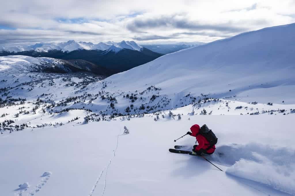
5. Powder Highway
Cranbrook Loop: 1,104 km
This scenic highway in eastern British Columbia showcases the Kootenay Rockies in their winter finery. The Powder Highway along BC Highway 95A connects eight major ski resorts, small mountain towns and hot springs. Of course, the best time to experience this roadtrip is during the winter months – the entire region is a wonderland for skiers and snow lovers.
Winding through mountain towns like Cranbrook, Nelson, Revelstoke, Golden, and Fernie, the Powder Highway is all about accessing the eight major ski resorts. These include; Revelstoke Mountain Resort, Kicking Horse Mountain Resort, Panorama Mountain Resort, Kimberly Alpine Resort, Fernie Alpine Resort, and Fairmont Hot Springs Resort. Many of these resorts and mountain towns have access to the added bonus of hot springs (see below). These are the perfect après ski activity.
Few travelers have the entire winter to explore every mountain resort in depth, so it’s best to plan a trip to this powder paradise in sections over several winter seasons.
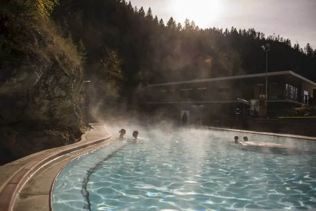
6. Hot Springs Route
Cranbrook Loop: 850 km
Starting in Cranbrook, in eastern British Columbia, the 850 km Hot Springs Route shares similarities of route and location to the winter sports-focused Powder Highway (see above). Driving the entire scenic loop through Creston, Nakusp, Revelstoke, Golden and can take seven days if you choose to stop and soak in the seven hot springs through the BC Canadian Rockies. Which of course, you must. I mean, seven days, seven hot springs, right?
In addition to hot springs like Fairmont, Radium and Ainsworth Hot Springs, this route also showcases incredible mountain wildlife, Kootenay National Park, Mount Revelstoke, and the Creston Valley Wildlife Management Area. Stop in the village of New Denver on Slocan Lake, to visit the Nikkei Internment Memorial Centre. This museum and National Historic Site is dedicated to the history of the internment of Japanese Canadians during World War II.
Use the map below to search for hotel and short-term rental options
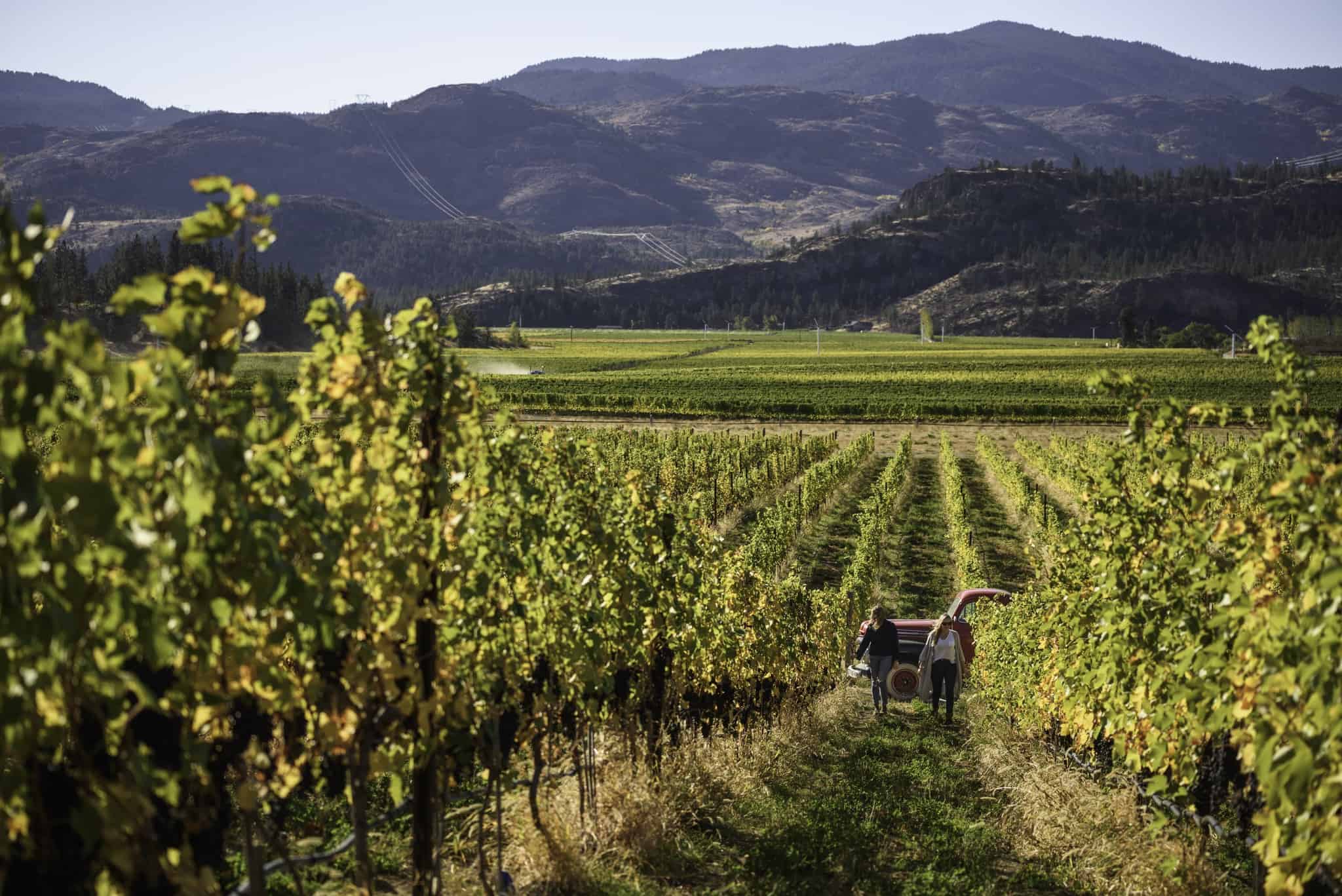
7. Wine Country Route
Osoyoos to Vernon: 176 km
Discover the fertile Okanagan valley, home to British Columbia’s largest wine region and only desert. This Wine Country Route drive along Highway 97 showcases some of the warmest lakes in the country. Rolling desert hills dotted with wineries and neat rows of green vines.
Starting in Osoyoos, enjoy a refreshing dip in BC’s warmest body of water, Lake Osoyoos. Then tour the First Nations Nk’Mip Desert Cultural Centre. Pass rows of symmetrical grapevines and pull in for some wine tastings at Rust, Culmina, Checkmate, vinAmité and Road 13 along the the Golden Mile Bench between Osoyoos and Oliver. Be sure to stop at local fruit stands along the way. They’re great spots for snacks and seasonal produce like cherries, apricots and peaches during summer.
Keep a sharp eye out for the legendary Ogopopo in Lake Okanagan on route to Kelowna. Enjoy more wine tastings at Cedar Creek Winery or St. Hubertus. Sample craft cocktails and pizza at Jack’s Pizza, and hand-crafted artisanal gelato at QB Gelato. Vernon and Lake Country await at the top end of this route. Vernon has a walkable downtown, can’t-miss donuts at Ratio Coffee & Pastry, and many outdoor activities. Try paddle boarding and wake boarding on Kalamalka Lake.
8. Northern BC Alaska Highway
Prince George to Whitehorse: 1,620 km
Prepare for epic vistas of lakes, trees, mountains and wildlife along BC Highway 97, better known as the Alaska Highway. This feat of engineering winds its way north, linking small towns and vast landscapes as one of the ultimate BC roadtrips.
Starting in Prince George, the gateway to Northern BC, the road showcases the true vastness of British Columbia. Attractions include Mile 0 at Dawson Creek, the Sign Post Forest at Watson Lake, countless lakes and rivers. There’s Stone Mountain and Muncho Lake Provincial Parks, rolling hills, the northern Rocky Mountains, and towns like Fort St. John and Fort Nelson.
Stop at Liard River Hot Springs Provincial Park to camp and soak in the nearby hot pools. They’re the second largest in Canada. As always, keep watch for the spectacular wildlife, including moose, wolves, eagles, bighorn sheep, grizzly and black bears.
The highway crosses into the Yukon at Watson Lake, where travelers continue towards the territory capital of Whitehorse. This former gold rush town hosts a variety of arts, culture and natural attractions. Some of these include the MacBride Museum, the Yukon Beringia Interpretive Centre, Miles Canyon basalt cliffs, the restored S.S. Klondike sternwheeler, and the Takhini Hot Pools.
Check out my friends’ Mike and Anne’s awesome road trip adventures if you’re looking to continue north for an Alaska road trip.
One last tip: If you’re driving a rental car, be sure to confirm with the rental car agency that you’re able to travel on your intended routes.
Pin for Later
Do you have a favorite driving route in British Columbia? Share it below.
Photo Credits: Claudia Laroye, Destination British Columbia

- 7 fave hangouts to enjoy the best ice cream in Vancouver - May 27, 2026
- How to plan an unforgettable 2 days in Vancouver - May 17, 2026
- Coming of age in the shadow of Chernobyl - April 26, 2026